
diff options
| author | Sebastian Leske <sebastian.leske@sleske.name> | 2017-09-06 19:15:18 +0200 |
|---|---|---|
| committer | Sebastian Leske <sebastian.leske@sleske.name> | 2017-09-06 19:15:18 +0200 |
| commit | 3299ac4db939c0cf964244e94bcb3de4156b2d86 (patch) | |
| tree | c65d4d9e7ceb8265a7812c2c90b69a05190f661b /README | |
| parent | 063e2c7ebdc1771de1bc7da7012ab2e2d6041540 (diff) | |
| download | navit-3299ac4db939c0cf964244e94bcb3de4156b2d86.tar.gz | |
Fix:core:Rename README.md to README, since some external builds need a README.
Diffstat (limited to 'README')
| -rw-r--r-- | README | 90 |
1 files changed, 90 insertions, 0 deletions
@@ -0,0 +1,90 @@ +[](https://circleci.com/gh/navit-gps/navit) + +Navit on Android tablet: + +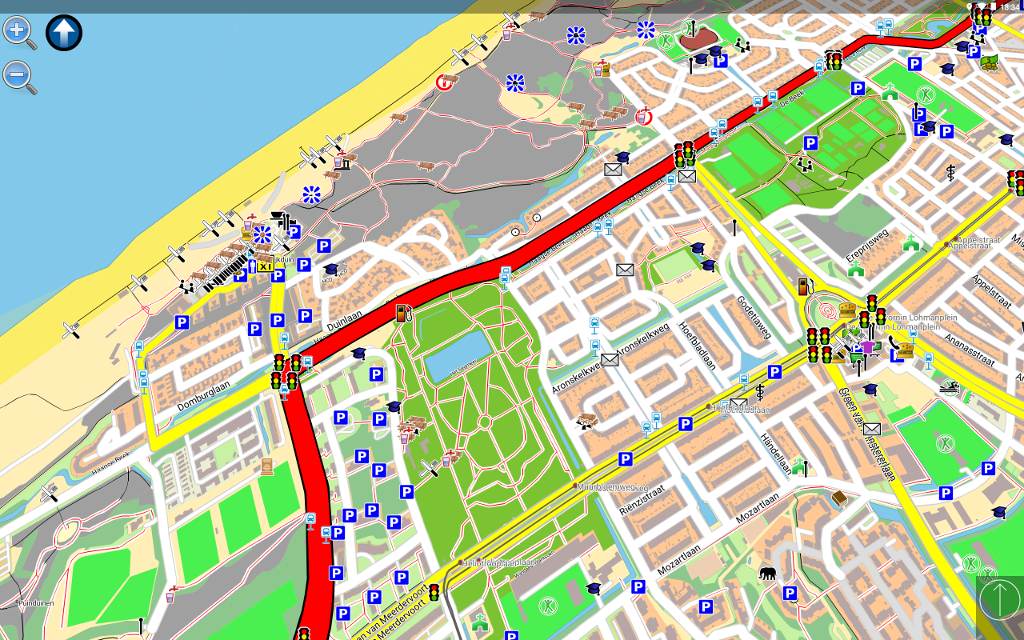 + +Navit on Linux based Carputer: + + + +<p> +<a href="https://play.google.com/store/apps/details?id=org.navitproject.navit"><img src="http://switzerland.tasis.com/uploaded/images2/appstore_button_google.png" height="100"/></a> + +<a href="https://f-droid.org/repository/browse/?fdfilter=navit&fdid=org.navitproject.navit"><img src="https://upload.wikimedia.org/wikipedia/commons/thumb/0/0d/Get_it_on_F-Droid.svg/200px-Get_it_on_F-Droid.svg.png" height="100"/></a> +</p> + +NavIT +===== + +Navit is a open source (GPL) car navigation system with routing engine. + +It's modular design is capable of using vector maps of various formats +for routing and rendering of the displayed map. It's even possible to +use multiple maps at a time. + +The GTK+ or SDL user interfaces are designed to work well with touch +screen displays. Points of Interest of various formats are displayed +on the map. + +The current vehicle position is either read from gpsd or directly from +NMEA GPS sensors. + +The routing engine not only calculates an optimal route to your +destination, but also generates directions and even speaks to you. + +Navit currently speaks over 70 languages! + +You can help translating via our web based translation page : + http://translations.launchpad.net/navit/trunk/+pots/navit + + +For help or more information, please refer to the wiki : + http://wiki.navit-project.org + +If you don't know where to start, we recommend you to read the +Interactive Help : http://wiki.navit-project.org/index.php/Interactive_help + + +Maps: +===== + +The best navigation system is useless without maps. Those three maps +are known to work: + +- OpenStreetMaps : display, routing, but street name search isn't complete + (see http://wiki.navit-project.org/index.php/OpenStreetMaps ) + +- Grosser Reiseplaner and compliant maps : full support + (see http://wiki.navit-project.org/index.php/European_maps ) + +- Garmin maps : display, routing, search is being worked on + (see http://wiki.navit-project.org/index.php/Garmin_maps ) + + +GPS Support: +============ + +Navit read the current vehicle position : +- directly from a file +- from gpsd (local or remote) +- from udp server (friends tracking) (experimental) + + +Routing algorithm +================= + +NavIt uses a Dijkstra algorithm for routing. The routing starts at the +destination by assigning a value to each point directly connected to +destination point. The value represents the estimated time needed to +pass this distance. + +Now the point with the lowest value is choosen using the Fibonacci +heap and a value is assigned to connected points whos are +unevaluated or whos current value ist greater than the new one. + +The search is repeated until the origin is found. + +Once the origin is reached, all that needs to be done is to follow the +points with the lowest values to the destination. + |